The Parish Atlas of England: Atlas of English Parish Boundaries - Tim C. H. Cockin
de: Tim C. H. Cockin
Publicat de: Malthouse Press
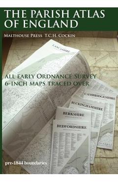
Anunta-ma cand revine pe stoc!An atlas old English PARISHES for the general user, local historians and genealogists. Using desktop publishing and high capacity memory personal computers the 19th Century Ordnance Survey 6-Inch County series maps have been traced over at 16.8mm (0.6619 inch) to 1 mile with readable text, combined with information from tithe maps and other sources. This is seven-year, solo, labour of love project by T.C.H. Cockin contains all 39 counties of England, with consideration to the possibility panels can make wall charts or fold-outs for separate publication.
| General | |
| Anul | 2017 |
| Autor | Tim C. H. Cockin |
| Categoria | Maps & Road Atlases |
| Editura | Malthouse Press |
| Pagini | 900 |
| Format | Softcover |
RECENZII The Parish Atlas of England: Atlas of English Parish Boundaries - Tim C. H. Cockin de Tim C. H. Cockin
Nu exista inca nicio recenzie scrisa!