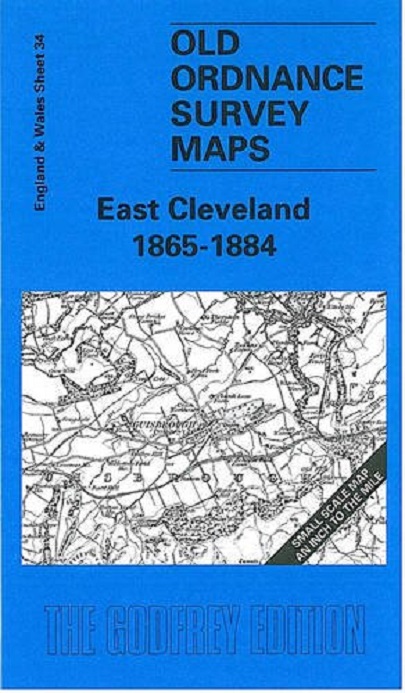
Here is information about Sheet 34: One Inch Sheet 34 East Cleveland 1865-84 - published 2001; intro by Robert Woodhouse. ISBN.978-1-84151-266-2 This early One Inch Ordnance Survey map covers the area from Redcar and Guisbrough eastward to Staithes and Runswick Bay. The moors - Guisbrough Moor, Commondale Moor, Danby Low Moor - along the foot of the map show that we are on the edge of the North Yorkshire Moors. Various railways curve through the area, including the Guisbrough & Saltburn line, with mineral lines for iron ore. The seaside resort of Saltburn is still just a village. On the reverse is a detailed map of Loftus, accompanied by a directory. It is not possible to list the many hamlets, farmsteads and other topographical features shown on these maps. However, you may find it useful if we list the towns and principal villages or church parishes that are included on this map. Links are given for those for which detailed large-scale maps are also available. Yorkshire North Riding: Ayton, Boulby, Easington, East Coatham, Guisbrough, Hinderwell, Kettleness, Kirkleatham, Lofthouse or Loftus, Lythe, Marske, Redcar, Saltburn, Skelton, Skinningrove, Staithes, Upleatham, Wilton.
| General | |
| Colectie | Old O.S. Maps of England and Wales |
| Anul | 2001 |
| Dimensiuni | H: 21cm | l: 13cm | 0.3cm | 24g |
| Editura | Alan Godfrey Maps |
| ISBN | 9781841512662 |
| Limba | Engleza |
| Format | Softcover |
RECENZII East Cleveland 1865-84
Nu exista inca nicio recenzie scrisa!